1981 Aerial Survey Map
IMAGE
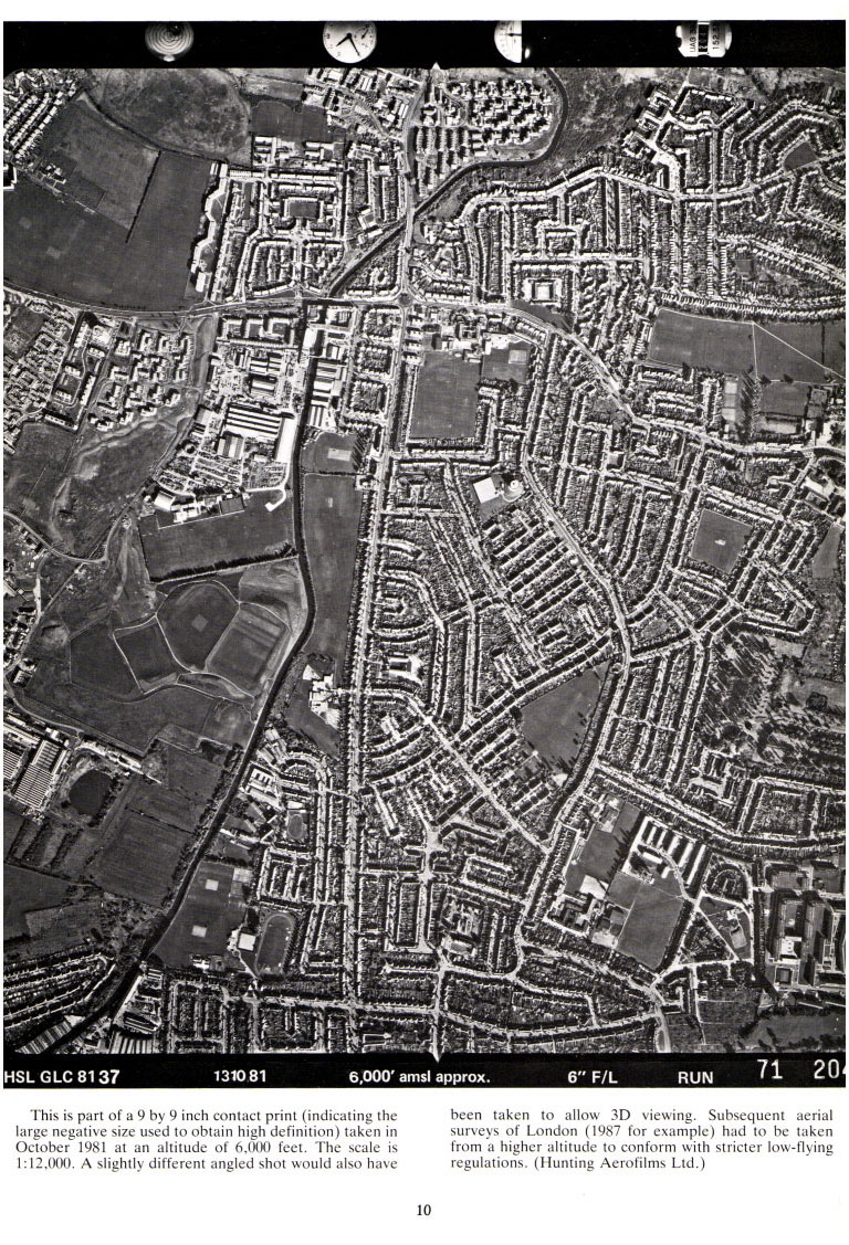
This is part of a 9 by 9 inch contact print (indicating the large negative size used to obtain high definition) taken in October 1981 at an altitude of 6,000 feet.
The scale is 1:12,000, A slightly different angled shot would also have been taken to allow 3D viewing.
Subsequent aerial surveys of London (1987 for example) had to be taken from a higher altitude to conform with stricter low-flying regulations.
Hunting Aerofilms Ltd.)
page 10


 Page 10